
WiPaD – Roughness Parametrization of Thin Layer Surface Runoff on Natural Surfaces
- Contact:
- Startdate:
2022
- Enddate:
2024
Client: Landesanstalt für Umwelt Baden-Württemberg (LUBW)
Motivation / Objective
-
Every year, heavy rain events cause an average of 40 million euros in damage in Baden-Württemberg (BW). Due to climate change, an increase in extreme heavy rain events is expected in the future.
-
Due to the availability of high-resolution topographical information and the experience of many engineering companies with the use of two-dimensional flow models for river modeling, the state of BW recommends and financially suppports the creation of 2D hydraulic models for heavy rain hazard mapping.
-
The use of common 2D simulation programs for heavy rain simulation is currently still subject to considerable uncertainties, especially with regard to the parameterization of the flow resistance behavior of thin layer surface runoff on natural surfaces (meadows, arable land).
-
Within the framework of the project, a better process understanding of the unsteady small-scale hydraulic processes of the thin layer surface runoff (e.g. runoff concentration and retention effects) should be developed. For this purpose, a survey plot was equipped with complex sensors ("mobile field laboratory") and possibilities for in-situ examination of any runoff scenarios on a real meadow area. Based on the knowledge gained, well-founded approaches or parameter recommendations for the practice of heavy rain modeling can be derived. In addition, it is examined to what extent modern remote sensing methods enable an efficient recording of the relevant input variables.
Methods / Results
-
Recording of the roughness structures of real (natural) surfaces that change over the course of the year.
-
Evaluation of different measuring platforms (terrestrial or drone-based) and measuring methods (laser scan or photogrammetric) for topography and roughness recording.
-
Conception of a novel type of mobile test stand in the field laboratory for in-situ measurement (PIV, PTV, Tracer, Laserscan) of relevant hydraulic processes on natural surfaces.
-
Acquisition of areal parameters of thin layer surface runoff using hybrid model technology (in-situ measurements and high-resolution 3D simulations).
-
Development and validation of an adequate parameter set / calculation approach for flow resistance modeling in numerical 2D models.
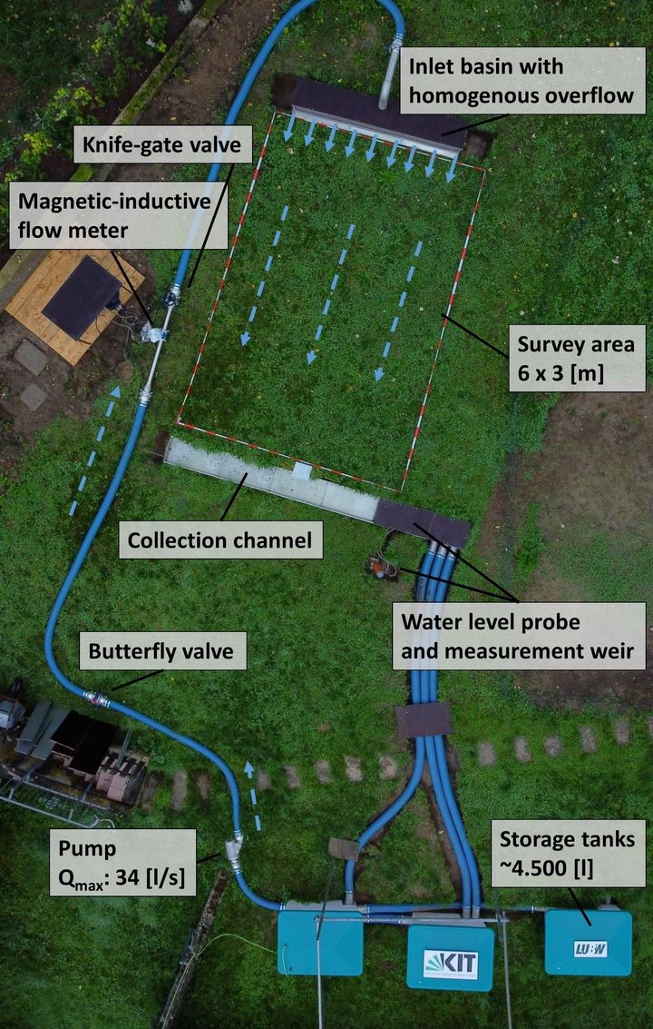
Fig. 1: Experimental setup field laboratory with representation of the individual components
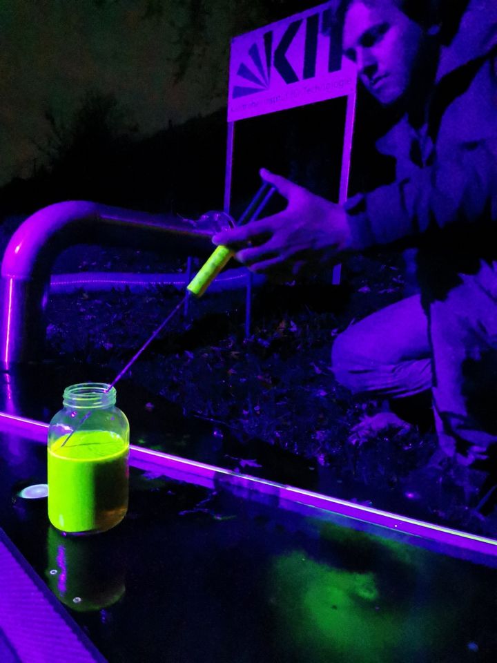
Fig. 2: Preparation of a flow velocity measurement with a fluorescent tracer
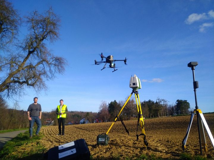
Fig. 3: Measurement campaign on a field with terrestrial laser scanner and drone-based lidar measurement
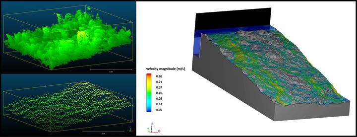
Fig. 4: Raw data filtering (vegetation) of a point cloud (left) and exemplary simulated surface runoff using high-resolution 3D numerics (right)